| Velino | |
|---|---|
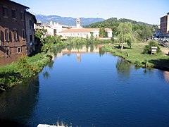
 The Velino River before the Cascata delle Marmore | |
 | |
| Location | |
| Country | Italy |
| Physical characteristics | |
| Source | |
| - location | Monte Pizzuto |
| Mouth | Nera |
| - coordinates | 42°33′12″N 12°42′50″E / 42.5533°N 12.7138°E |
| Length | 90 km (56 mi) |
| Basin size | 2,238 km2 (864 sq mi) |
| Discharge | |
| - average | 60 m3/s (2,100 cu ft/s) |
| Basin features | |
| Progression | Nera→ Tiber→ Tyrrhenian Sea |
The Velino is a river in central Italy that flows through the Lazio and Umbria regions but flows mainly through the Lazio region. It is the main tributary of the Nera river which is a tributary of the Tiber river.
Geography
[change | change source]The Velino river has a length of 90 km (56 mi), and a drainage basin with an area of approximately 2,238 km2 (864 sq mi).[1]
Course
[change | change source]The Velino river starts on the sides of the Monte Pozzoni at an elevation of about 1,667 m (5,469 ft), in the comune of Cittareale, Province of Rieti, Lazio.[2]
The river flows first to the south through the comuni of Cittareale and Posta and goes into a narrow valley with the Monte Terminillo to the west and the Monte Giano to the east; after about 15 km (9 mi), it leaves the valley and gets in the Antrodoco comune. The river then turns to the west and flow through the comuni of Borgo Velino and Castel Sant'Angelo. Then the river gets the water of the "Peschiera Springs".
After getting into the Piana Reatina ("Plain of Rieti"), an important valley, the river flows through the city of Rieti. At the end of the plain, the Velino river joins the Nera river and forms the Cascate delle Marmore falls.
Main tributaries
[change | change source]Only the tributaries coming from the left of the Velino are of some importance; those coming from the right are small streams.
Left tributaries:
- Salto - 55 km
- Turano - 70 km
Gallery
[change | change source]-
 The summit of Monte Pozzoni.
 -
 The Velino in Rieti.
 -
 Bridge over the Velino in Rieti.
 -
 Cascate delle Marmore falls where the Velino joins the Nera.
 -
 Cascate delle Marmore.
.jpg)


.jpg)

Related pages
[change | change source]References
[change | change source]- ↑ "Velino" (in Italian). Treccani.it - Enciclopedie on line. Retrieved 10 August 2017.
- ↑ "Sintesi degli Studi Relativi all'Istituzione del Parco del Vellino" (PDF) (in Italian). CRITEVAT. pp. 29–30. Archived from the original (PDF) on 26 April 2016. Retrieved 10 August 2017.
Other websites
[change | change source]- Fiumi Italiani: Fiume Velino (in Italian)