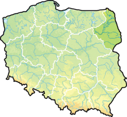
Podlaskie Voivodeship
Województwo podlaskie | |
|---|---|
 Location within Poland | |
| Coordinates (Białystok): 53°7′N 23°10′E / 53.117°N 23.167°E | |
| Country | |
| Capital | Białystok |
| Counties | |
| Government | |
| • Type | Voivodeship |
| • Body | Podlaskie Regional Assembly |
| Area | |
| • Total | 20,180 km2 (7,790 sq mi) |
| Population (30-06-2014) | |
| • Total | 1,193,348 |
| • Density | 59/km2 (150/sq mi) |
| • Urban | 712,675 |
| • Rural | 484,935 |
| ISO 3166 code | PL-20 |
| Vehicle registration | B |
| Website | bialystok.uw.gov.pl |
| |
Podlaskie Voivodeship is a Voivodeship (province) of Poland. The capital and largest city is Białystok. The province was created on 1 January 1999.
Białowieża Forest and Knyszyń Forest are in Podlaskie.
| International | |
|---|---|
| National | |
| Geographic | |
| Other | |


