Auburn, Kansas | |
|---|---|
 Downtown Auburn (2008) | |
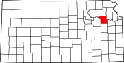
 Location within Shawnee County and Kansas | |
 | |
| Coordinates: 38°54′28″N 95°48′56″W / 38.90778°N 95.81556°W[1] | |
| Country | United States |
| State | Kansas |
| County | Shawnee |
| Founded | 1856 |
| Incorporated | 1963 |
| Area | |
| • Total | 0.70 sq mi (1.81 km2) |
| • Land | 0.70 sq mi (1.80 km2) |
| • Water | 0.00 sq mi (0.01 km2) |
| Elevation | 1,079 ft (329 m) |
| Population | |
| • Total | 1,273 |
| • Density | 1,800/sq mi (700/km2) |
| Time zone | UTC-6 (CST) |
| • Summer (DST) | UTC-5 (CDT) |
| ZIP code | 66402 |
| Area code | 785 |
| FIPS code | 20-03250 [1] |
| GNIS ID | 2394025[1] |
| Website | auburnks.com |
Auburn is a city in Shawnee County, Kansas, United States. In 2020, 1,273 people lived there.[3]