Athol, Kansas | |
|---|---|
 (2021) | |
 Location within Smith County and Kansas | |
 | |
| Coordinates: 39°45′58″N 98°55′11″W / 39.76611°N 98.91972°W[1] | |
| Country | United States |
| State | Kansas |
| County | Smith |
| Founded | 1888 |
| Incorporated | 1911 |
| Area | |
| • Total | 0.19 sq mi (0.48 km2) |
| • Land | 0.19 sq mi (0.48 km2) |
| • Water | 0.00 sq mi (0.00 km2) |
| Elevation | 1,791 ft (546 m) |
| Population | |
| • Total | 41 |
| • Density | 220/sq mi (85/km2) |
| Time zone | UTC-6 (CST) |
| • Summer (DST) | UTC-5 (CDT) |
| ZIP code | 66932 |
| Area code | 785 |
| FIPS code | 20-03025 |
| GNIS ID | 2394011[1] |
Athol is a city in Smith County, Kansas, United States. In 2020, 41 people lived there.[3]
History
[change | change source]Athol was created in 1888.[4] The first post office in Athol was created in February 1888.[5]
Athol was a station and shipping point on the Chicago, Rock Island and Pacific Railroad.[6]
In the 1870s, the song Home on the Range was written by Dr. Brewster Higley in a cabin 8 miles (13 km) north of Athol.[7]
Geography
[change | change source]Athol is at 39°45′58″N 98°55′11″W / 39.76611°N 98.91972°W (39.766191, -98.919748). The United States Census Bureau says that the city has a total area of 0.19 square miles (0.48 km2). All of it is land.[2]
People
[change | change source]| Historical population | |||
|---|---|---|---|
| Census | Pop. | %± | |
| 1920 | 294 | — | |
| 1930 | 280 | −4.8% | |
| 1940 | 248 | −11.4% | |
| 1950 | 203 | −18.1% | |
| 1960 | 140 | −31.0% | |
| 1970 | 108 | −22.9% | |
| 1980 | 90 | −16.7% | |
| 1990 | 86 | −4.4% | |
| 2000 | 51 | −40.7% | |
| 2010 | 44 | −13.7% | |
| 2020 | 41 | −6.8% | |
| U.S. Decennial Census | |||
2020 census
[change | change source]The 2020 census says that there were 41 people, 25 households, and 19 families living in Athol. Of the households, 88.0% owned their home and 12.0% rented their home.
The median age was 46.8 years. All of the people were White and none were Hispanic or Latino.[3][8]
2010 census
[change | change source]The 2010 census says that there were 44 people, 17 households, and 14 families living in Athol.[9]
References
[change | change source]- ↑ 1.0 1.1 1.2 "Athol, Kansas". Geographic Names Information System. United States Geological Survey.
- ↑ 2.0 2.1 "2020 U.S. Gazetteer Files". United States Census Bureau. Retrieved December 8, 2023.
- ↑ 3.0 3.1 3.2 "DP1: PROFILE OF GENERAL POPULATION AND HOUSING CHARACTERISTICS". United States Census Bureau. Retrieved December 8, 2023.
- ↑ Kansas State Historical Society (1916). Biennial Report of the Board of Directors of the Kansas State Historical Society. Kansas State Printing Plant. p. 301.
- ↑ "Kansas Post Offices, 1828-1961". Kansas Historical Society. Archived from the original on October 9, 2013. Retrieved 23 June 2014.
- ↑ Blackmar, Frank Wilson (1912). Kansas: A Cyclopedia of State History, Embracing Events, Institutions, Industries, Counties, Cities, Towns, Prominent Persons, Etc. Standard Publishing Company. p. 116. ISBN 9780722249055.
- ↑ DeLano, Patti & Smarsh, Sarah (2010). Kansas Off the Beaten Path, 9th: A Guide to Unique Places. Globe Pequot. p. 209. ISBN 9780762765676.
- ↑ "P16: HOUSEHOLD TYPE". United States Census Bureau. Retrieved December 30, 2023.
- ↑ "American FactFinder". United States Census Bureau. Retrieved 2012-07-06.
Other websites
[change | change source]- City
- Schools
- USD 237, local school district
- Historical
- Home on the Range Cabin, cabin where the song Home on the Range was written.
- Maps
- Athol City Map, KDOT
Municipalities and communities of Smith County, Kansas, United States | ||
|---|---|---|
| Cities | 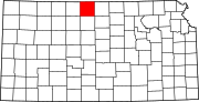 | |
| Unincorporated communities |
| |
| Ghost towns |
| |