| Arroux | |
|---|---|
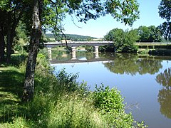
 The Arroux in Autun | |
 | |
| Location | |
| Country | France |
| Physical characteristics | |
| Source | |
| - location | Burgundy |
| Mouth | |
| - location | Loire |
| - coordinates | 46°29′24″N 3°57′33″E / 46.49000°N 3.95917°E |
| Length | 128.1 km (79.6 mi) |
| Basin size | 3,174 km2 (1,225 sq mi) |
| Discharge | |
| - average | 32 m3/s (1,100 cu ft/s) |
| Basin features | |
| Progression | Loire→ Atlantic Ocean |
The Arroux is a river in central France. It is a right tributary of the Loire river.
Geography
[change | change source]The Arroux river has a length of 129.4 km (80.4 mi),[1] and a drainage basin with an area of 3,166 km2 (1,222 sq mi).
Course
[change | change source]The Arroux river starts in Culètre commune in the south of the Côte-d'Or) department, at an altitude of about 430 m (1,411 ft).[2] From here, the Arroux flows first to the west and then to the southwest.
The Arroux river flows through 2 regions and 3 departments. It flows through the following communes, among others:[1]
- Bourgogne-Franche-Comté region
- Côte-d'Or: Arnay-le-Duc
- Saône-et-Loire: Autun, Étang-sur-Arroux, Toulon-sur-Arroux, Gueugnon, Digoin
- Auvergne-Rhône-Alpes region
- Allier: (only a short distance)
Finally, it flows into the Loire river near the town of Digoin.[3]
Main tributaries
[change | change source]The main tributaries of the Arroux river are:[1]
|
Left tributaries:
|
|
Right tributaries:
|
Hydrology
[change | change source]Its average yearly discharge (volume of water which passes through a section of the river per unit of time) is 34.20 m3/s (1,208 cu ft/s) at Digoin in the Saône-et-Loire department.[4]
Average monthly discharge (m3/s) at Digoin (1958 - 2017)[4]

Gallery
[change | change source]-
 The Arroux.
 -
 The Arroux in Vendenesse-sur-Arroux.
 -
 Vendenesse-sur-Arroux, bridger over the Arroux.
 -
 The Arroux in Gueugnon.
 -
 Confluence of the Arroux in the Loire.


Related pages
[change | change source]References
[change | change source]- ↑ 1.0 1.1 1.2 "L'Arroux (K1--0180))" (in French). SANDRE - Portail national d'accès aux référentiels sur l'eau. Retrieved 11 December 2017.
- ↑ "Source de l'Arroux" (in French). Géoportail. Retrieved 11 December 2017.
- ↑ "Confluence de l'Arroux" (in French). Géoportail. Retrieved 11 December 2017.
- ↑ 4.0 4.1 "L'Arroux à Digoin" (in French). Banque Hydro. Retrieved 11 December 2017.[permanent dead link]