Beit Hanoun | |
|---|---|
| Ither transcription(s) | |
| • Arabic | بيت حانون |
| • An aa spelled | Beit Hanun (official) Bayt Hanun (unofficial) |
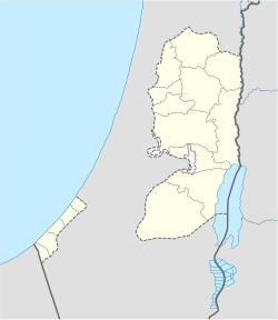
Location o Beit Hanoun within the Palestinian territories | |
| Coordinates: 31°32′29″N 34°32′11″E / 31.54139°N 34.53639°ECoordinates: 31°32′29″N 34°32′11″E / 31.54139°N 34.53639°E | |
| Palestine grid | 105/105 |
| Govrenorate | North Gaza |
| Govrenment | |
| • Teep | Ceety |
| • Heid o Municipality | Mohamad Nazek al-Kafarna |
| Area | |
| • Jurisdiction | 12.5 km2 (4.8 sq mi) |
| Population (2006) | |
| • Jurisdiction | 32,187 |
| Name meanin | "The house of Hanun"[1] |
| Website | www.beithanoun.ps |
Beit Hanoun (Arabic: بيت حانون) is a ceety on the north-east edge o the Gaza Strip. Accordin tae the Palestinian Central Bureau o Statistics, the toun haed a population o 32,187 in mid-year 2006.[2] It is locatit bi the Hanoun stream, juist 6 kilometer (3.7 mi) away frae the Israeli toun o Sderot.
Demographics
[eedit | eedit soorce]Beit Hanoun haed a population o 885 in a 1922 Breetish Mandate census.[3] The population mair nor doubled bi 1945. In that year, a land an population survey recorded 1,730 indwallers includin 50 Jews.[4] In 1961, the population rose tae 3,876.[3]
In the first offeecial census bi the Palestinian Central Bureau o Statistics (PCBS), Beit Hanoun haed a tot population o 20,780. Ower 90% o the residents wur Palestinian refugees.[5] Thare wur 10,479 males an 10,301 females. The age distribution wis as follaes: Fowk 14 years o age or younger constitutit the majority at 65.6%, fowk atween the ages o 20 an 44 wis 26.8%, 45 tae 64 wis 5.7% an residents abuin the age o 65 wis 1.9%.[6]
Local infrastructur
[eedit | eedit soorce]Thare are twal seicontary, primary an agricultural schuils in Beit Hanoun an an agricultural college which is relatit tae al-Azhar University - Gaza. Thare is a medical centre an hospital in the ceety an several clinics maistly managed bi the Unitit Naitions.[7]
References
[eedit | eedit soorce]- ↑ Palmer, 1881, p. 358
- ↑ Projected Mid -Year Population Archived 2012-02-12 at the Wayback Machine for North Gaza Governorate by Locality 2004– 2006 Palestinian Central Bureau of Statistics
- ↑ a b Welcome To Bayt Hanun
- ↑ Hadawi, Sami. (1970). Gaza District Statistics[deid airtin] from Village Statistics of 1945: A Classification of Land and Area ownership in Palestine The Palestine Liberation Organization Research Center.
- ↑ Palestinian Population by Locality and Refugee Status Archived 2008-11-18 at the Wayback Machine Palestinian Central Bureau of Statistics (PCBS).
- ↑ Palestinian Population by Locality, Sex and Age Groups in Years Archived 2008-11-18 at the Wayback Machine Palestinian Central Bureau o Statistics (PCBS).
- ↑ Our City Archived 2012-02-16 at the Wayback Machine Beithanoun Municipality.
