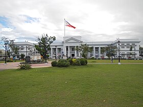
Pampanga
Luyag na Filipinas
Laylay na Pampanga
Laylay
Opisyal ya selyo na Pampanga
Selyo
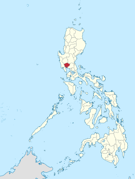
Lokasyon na Pampanga
Map
15°4′12″N 120°40′12″E
Dalin Filipinas
Angipaletnegan 1571
Kabesera San Fernando
Barangay 538
Gobiyerno
 • Pangulo Dennis Pineda
Kaawang
 • Katiponan 2,002.20 km2 (773.05 sq mi)
Bilang na too (Mayo 1, 2020)[1]
 • Katiponan 2,437,709
 • Densidad 1,200/km2 (3,200/sq mi)
Economia
 • Clase unaan ya klase a luyag
 • Ingresos ₱3,877,190,307.20 (2020)
 • Activos ₱12,674,123,243.52 (2020)
 • Pasivos ₱2,400,378,532.11 (2020)
 • Gastos ₱2,127,059,152.60 (2020)
Kodigo na postal 2000–2024
Kodigo na lugar 45
Website www.pampanga.gov.ph

Say Pampanga et unaan ya klase a luyag ed rehiyon na Pegley na Luzon, Filipinas. Unong ed 1 Mayo 2020 census, say populasyon to et 2,437,709 totoo tan 573,920 abong. Walay kabaleg tan sukat to ya 2,002.20 sq. km. Say kodigo telefono +63 (0)45. Say kapital to et San Fernando.

Saray siyudad san baley

Say Pampanga walay 2 ya siyudad san 20 ya baley.

Saray siyudad

Saray baley

Demograpiko

Sensus na populasyon ed
Pampanga
TaonPop.±% p.a.
1903 223,754—    
1918 257,620+0.94%
1939 375,281+1.81%
1948 416,583+1.17%
1960 617,259+3.33%
1970 772,731+2.27%
1975 891,000+2.90%
1980 992,756+2.19%
1990 1,295,929+2.70%
1995 1,401,756+1.48%
2000 1,618,759+3.13%
2007 1,911,951+2.32%
2010 2,014,019+1.91%
2015 2,198,110+1.68%
2020 2,437,709+2.06%
Reperensiya: Philippine Statistics Authority[2][3][4]

Saray reperensiya

  1. "2020 Census of Population and Housing (2020 CPH) Population Counts Declared Official by the President". Hulyo 7, 2021. https://psa.gov.ph/content/2020-census-population-and-housing-2020-cph-population-counts-declared-official-president. 
  2. Census of Population (2015). "Region III (Central Luzon)". Total Population by Province, City, Municipality and Barangay. PSA. Retrieved 29 June 2016.
  3. Census of Population and Housing (2010). "Region III (Central Luzon)". Total Population by Province, City, Municipality and Barangay. NSO. Retrieved 29 June 2016.
  4. Censuses of Population (1903–2007). "Region III (Central Luzon)". Table 1. Population Enumerated in Various Censuses by Province/Highly Urbanized City: 1903 to 2007. NSO.

Saray gawing ed labas

Saray Region san Luyag na Luzon
Sagor na Baybay na Luzon: Ilocos ed Baybay (Ilocos Norte) | Ilocos ed Abalaten (Ilocos Sur) | La Union | Pangasinan
Valley na Cagayan: Batanes | Cagayan | Isabela | Balon Vizcaya (Nueva Vizcaya) | Quirino
Cordillera Administrative Region: Abra | Apayao | Benguet | Ifugao | Kalinga | Luyag na Palandey
Pegley na Luzon: Aurora | Bataan | Bulacan | Balon Ecija (Nueva Ecija) | Pampanga | Tarlac | Zambales
CALABARZON: Batangas | Cavite | Laguna | Quezon | Rizal
MIMAROPA: Mindoro ed Bokig (Oriental Mindoro) | Mindoro ed Sagor (Occidental Mindoro) | Romblon | Marinduque
Rehiyon na Bikol: Albay | Camarines ed Abalaten (Camarines Sur) | Camarines ed Baybay (Camarines Norte) | Catanduanes | Masbate | Sorsogon
Metro Manila: Agnaluyag