Nulla maior resolutio exstat.
Karta_AngkorWat.PNG (700 × 550 elementa imaginalia, magnitudo fasciculi: 21 chiliocteti, typus MIME: image/png)

|
This map image could be re-created using vector graphics as an SVG file. This has several advantages; see Commons:Media for cleanup for more information. If an SVG form of this image is available, please upload it and afterwards replace this template with
((vector version available|new image name)).
It is recommended to name the SVG file “Karta AngkorWat.svg”—then the template Vector version available (or Vva) does not need the new image name parameter. |
Summarium
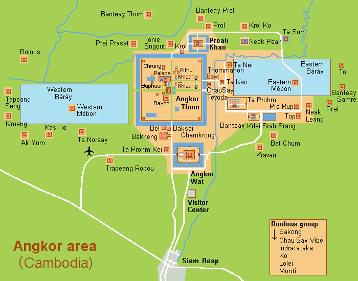
| Descriptio |
English: Map (rough) of Angkor Wat, Cambodja. |
| Datum | |
| Fons | Opus proprium , composed from various mapreferences |
| Auctor | Hobe / Holger Behr |
Potestas usoris
| I, the copyright holder of this work, release this work into the public domain. This applies worldwide. In some countries this may not be legally possible; if so: I grant anyone the right to use this work for any purpose, without any conditions, unless such conditions are required by law. |
