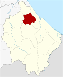
District in Narathiwat, Thailand
Yi-ngo (Thai: ยี่งอ, pronounced [jîː.ŋɔ̄ː]; Pattani Malay: ยือรีงา, pronounced [jɯː.riː.ŋāː]) is a district (amphoe) of Narathiwat province, southern Thailand.
Geography
Neighboring districts are (from the north clockwise): Bacho, Mueang Narathiwat, Ra-ngae, and Rueso.
History
Yi-ngo was originally a district in Sai Buri Province. In 1909 it was reassigned to Bang Nara Province, present-day Narathiwat Province.[1]
Administration
Central administration
Yi-ngo district is divided into six sub-districts (tambons), which are further subdivided into 40 administrative villages (mubans).
| No.
|
Name
|
Thai
|
Villages
|
Pop.[2]
|
| 01. |
Yi-ngo |
ยี่งอ |
07 |
9,760
|
| 02. |
Lahan |
ละหาร |
08 |
8,088
|
| 03. |
Cho Bo |
จอเบาะ |
09 |
8,402
|
| 04. |
Lubo Baya |
ลุโบะบายะ |
05 |
4,537
|
| 05. |
Lubo Buesa |
ลุโบะบือซา |
06 |
4,951
|
| 06. |
Tapoyo |
ตะปอเยาะ |
05 |
9,079
|
Local administration
There is one sub-district municipality (thesaban tambon) in the district:
- Yi-ngo (Thai: เทศบาลตำบลยี่งอ) consisting of parts of sub-district Yi-ngo.
There are six subdistrict administrative organizations (SAO) in the district:
- Yi-ngo (Thai: องค์การบริหารส่วนตำบลยี่งอ) consisting of parts of sub-district Yi-ngo.
- Lahan (Thai: องค์การบริหารส่วนตำบลละหาร) consisting of sub-district Lahan.
- Cho Bo (Thai: องค์การบริหารส่วนตำบลจอเบาะ) consisting of sub-district Cho Bo.
- Lubo Baya (Thai: องค์การบริหารส่วนตำบลลุโบะบายะ) consisting of sub-district Lubo Baya.
- Lubo Buesa (Thai: องค์การบริหารส่วนตำบลลุโบะบือซา) consisting of sub-district Lubo Buesa.
- Tapoyo (Thai: องค์การบริหารส่วนตำบลตะปอเยาะ) consisting of sub-district Tapoyo.
