Wetzikon | |
|---|---|
 | |
 Coat of arms | |
Location of Wetzikon  | |
| Country | Switzerland |
| Canton | Zurich |
| District | Hinwil |
| Government | |
| • Mayor | Gemeindepräsident Urs Fischer FDP/PRD (as of 2008) |
| Area | |
| • Total | 16.73 km2 (6.46 sq mi) |
| Elevation | 535 m (1,755 ft) |
| Population (31 December 2018)[2] | |
| • Total | 24,764 |
| • Density | 1,500/km2 (3,800/sq mi) |
| Time zone | UTC+01:00 (Central European Time) |
| • Summer (DST) | UTC+02:00 (Central European Summer Time) |
| Postal code(s) | 8620 |
| SFOS number | 0121 |
| ISO 3166 code | CH-ZH |
| Localities | Ettenhausen, Kempten, Medikon, Oberwetzikon, Robenhausen, Unterwetzikon |
| Surrounded by | Bäretswil, Gossau, Hinwil, Mönchaltorf, Pfäffikon, Seegräben |
| Twin towns | Melnik (Czech Republic) |
| Website | www SFSO statistics |
Wetzikon is a municipality in the district of Hinwil in the canton of Zürich in Switzerland.
Geography

Wetzikon has an area of 16.7 km2 (6.4 sq mi). Of this area, 42.4% is used for agricultural purposes, while 17.6% is forested. Of the rest of the land, 27.9% is settled (buildings or roads) and the remainder (12.1%) is non-productive (rivers, glaciers or mountains).[3] In 1996[update] housing and buildings made up 20% of the total area, while transportation infrastructure made up the rest (7.9%).[4] Of the total unproductive area, water (streams and lakes) made up 3.3% of the area. As of 2007[update] 30.5% of the total municipal area was undergoing some type of construction.[4]
It is located near Lake Pfäffikon in the Zürcher Oberland, between Uster and Rapperswil-Jona.
Demographics
Wetzikon has a population (as of 31 December 2020) of 25,056.[5] As of 2007[update], 22.1% of the population was made up of foreign nationals. As of 2008[update] the gender distribution of the population was 49.2% male and 50.8% female. Over the last 10 years the population has grown at a rate of 18.8%. Most of the population (as of 2000[update]) speaks German (83.8%), with Italian being second most common ( 5.7%) and Albanian being third ( 1.9%).
In the 2007 election the most popular party was the SVP which received 37.6% of the vote. The next three most popular parties were the SPS (16.1%), the CSP (12.2%) and the Green Party (10.5%).
The age distribution of the population (as of 2000[update]) is children and teenagers (0–19 years old) make up 23.1% of the population, while adults (20–64 years old) make up 62% and seniors (over 64 years old) make up 15%.[3] There are 7929 households in Wetzikon.[4]

As of 2008[update] there were 6385 Catholics and 7772 Protestants in Wetzikon. In the 2000 census[update], religion was broken down into several smaller categories. From the 2000 census, 45% were some type of Protestant, with 40.3% belonging to the Swiss Reformed Church and 4.7% belonging to other Protestant churches. 31.3% of the population were Catholic. Of the rest of the population, 6.5% were Muslim, 8.7% belonged to another religion (not listed), 3.6% did not give a religion, and 10.6% were atheist or agnostic.[4]
Economics and education
The Kantonschule Zürcher Oberland (KZO) [6], or the "Kanti" as the gymnasium level learning institution is known in Swiss German, is based in Wetzikon due to its central location in the Zürich Oberland, as well as the Zürcher Oberländer [7] newspaper and the annual ZOM trade fair.[8].
The regional hospital, the Gesundheitsversorgung Zürcher Oberland [9] is also located there.
Wetzikon has an unemployment rate of 2.9%. As of 2005[update], there were 134 people employed in the primary economic sector and about 41 businesses involved in this sector. 3486 people are employed in the secondary sector and there are 255 businesses in this sector. 7054 people are employed in the tertiary sector, with 838 businesses in this sector.[3] As of 2007[update] 43.8% of the working population were employed full-time, and 56.2% were employed part-time.[4]
In Wetzikon about 69.4% of the population (between age 25-64) have completed either non-mandatory upper secondary education or additional higher education (either University or a Fachhochschule).[3]
World heritage site
The prehistoric settlement at Robenhausen is part of the Prehistoric Pile dwellings around the Alps a UNESCO World Heritage Site.[10]
Transportation
Wetzikon is a node of the Zürich S-Bahn on the lines S3, S14, S15 and S5. The town is a 20 minute (S5) ride from Zürich Hauptbahnhof.
Gallery
-

-
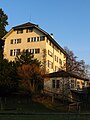
 Apartments buildings in Oberwetzikon, Alps in the background
 -
 Robenhuserriet in Robenhausen
 -
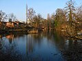 Aabach in Wetzikon
 -
 Auslikon and its Strandbad (lido) on Lake Pfäffikon shore
 -
 Schloss (castle) Wetzikon
 -
 Bahnhofstrasse between Oberwetzikon and Kempten


_IMG_4901.jpg)


References
- ^ a b "Arealstatistik Standard - Gemeinden nach 4 Hauptbereichen". Federal Statistical Office. Retrieved 13 January 2019.
- ^ https://www.zh.ch/de/politik-staat/gemeinden/gemeindeportraet.html. Retrieved 22 April 2021.
((cite web)): Missing or empty|title=(help) - ^ a b c d Swiss Federal Statistical Office accessed 06-Aug-2009
- ^ a b c d e Statistics Zurich Template:De icon accessed 4 August 2009
- ^ "Ständige und nichtständige Wohnbevölkerung nach institutionellen Gliederungen, Geburtsort und Staatsangehörigkeit". bfs.admin.ch (in German). Swiss Federal Statistical Office - STAT-TAB. 31 December 2020. Retrieved 21 September 2021.
- ^ Kantonschule Zürcher Oberland (KZO) Template:De icon
- ^ ZO online Template:De icon
- ^ Zürcher Oberland Messe (in Swiss-German "Züri Oberland Mäss") Template:De icon
- ^ Gesundheitsversorgung Zürcher Oberland Template:De icon
- ^ UNESCO World Heritage Site - Prehistoric Pile dwellings around the Alps
External links
- Official website Template:De icon
- Community website Template:De icon