County in Mazandaran province, Iran
County in Mazandaran, Iran
Sari County
|
|---|
|
 Location of Sari County in Mazandaran province (center right, purple) |
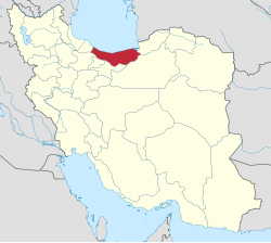 Location of Mazandaran province in Iran |
| Coordinates: 36°24′N 53°25′E / 36.400°N 53.417°E / 36.400; 53.417[1] |
| Country |  Iran Iran |
|---|
| Province | Mazandaran |
|---|
| Capital | Sari |
|---|
| Districts | Central, Chahardangeh, Dodangeh, Kolijan Rostaq, Rudpey, Rudpey-ye Shomali |
|---|
|
| • Total | 3,685.30 km2 (1,422.90 sq mi) |
|---|
|
| • Total | 504,298 |
|---|
| • Density | 140/km2 (350/sq mi) |
|---|
| Time zone | UTC+3:30 (IRST) |
|---|
| Sari County can be found at GEOnet Names Server, at this link, by opening the Advanced Search box, entering "-3196738" in the "Unique Feature Id" form, and clicking on "Search Database". |
Sari County (Persian: شهرستان ساری) is in Mazandaran province, Iran. Its capital is the city of Sari.[3]
History
After the 2006 National Census, Miandorud District was separated from the county in the establishment of Miandorud County.[4] Additionally,
Rudpey-ye Jonubi Rural District and Rudpey-ye Shomali Rural District were separated from the Central District in the establishment of Rudpey District.[5]
After the 2011 census, the village of Pain Hular was elevated to the status of a city.[6]
In 2013, Rudpey-ye Shomali Rural District and most of Rudpey-ye Gharbi Rural District were separated from Rudpey District in the establishment of Rudpey-ye Shomali District.[7]
After the 2016 census, the villages of Akand[8] and Farahabad[9] were elevated to city status.
Demographics
Population
At the time of the 2006 census, the county's population was 490,830 in 132,919 households.[10] The following census in 2011 counted 478,370 people in 145,339 households.[11] The 2016 census measured the population of the county as 504,298 in 165,467 households.[12]
Administrative divisions
Sari County's population history and administrative structure over three consecutive censuses are shown in the following table.
Sari County Population
| Administrative Divisions |
2006[10] |
2011[11] |
2016[12]
|
| Central District |
395,716 |
405,850 |
429,620
|
| Esfivard-e Shurab RD |
25,400 |
26,172 |
27,291
|
| Kolijan Rostaq-e Sofla RD |
16,953 |
21,579 |
21,813
|
| Mazkureh RD |
25,883 |
27,302 |
33,310
|
| Miandorud-e Kuchak RD |
33,905 |
34,380 |
37,386
|
| Rudpey-ye Jonubi RD |
20,548 |
|
|
| Rudpey-ye Shomali RD |
13,943 |
|
|
| Sari (city) |
259,084 |
296,417 |
309,820
|
| Chahardangeh District |
19,969 |
15,796 |
17,376
|
| Chahardangeh RD |
5,884 |
4,081 |
4,864
|
| Garmab RD |
6,610 |
5,533 |
5,804
|
| Poshtkuh RD |
3,885 |
3,345 |
3,324
|
| Kiasar (city) |
3,590 |
2,837 |
3,384
|
| Dodangeh District |
8,140 |
7,705 |
7,653
|
| Banaft RD |
3,209 |
2,979 |
2,759
|
| Farim RD |
4,751 |
4,454 |
4,525
|
| Farim (city) |
180 |
272 |
369
|
| Kolijan Rostaq District |
13,143 |
11,732 |
12,024
|
| Kolijan Rostaq-e Olya RD |
9,543 |
9,183 |
8,461
|
| Tangeh Soleyman RD |
3,600 |
2,549 |
2,607
|
| Pain Hular (city) |
|
|
956
|
| Miandorud District[a] |
53,862 |
|
|
| Kuhdasht RD |
20,601 |
|
|
| Miandorud-e Bozorg RD |
24,444 |
|
|
| Surak (city) |
8,817 |
|
|
| Rudpey District |
|
37,287 |
22,126
|
| Rudpey-ye Gharbi RD |
|
|
9,762
|
| Rudpey-ye Sharqi RD[b] |
|
21,830 |
12,364
|
| Rudpey-ye Shomali RD |
|
15,457 |
|
| Akand (city)[c] |
|
|
|
| Rudpey-ye Shomali District |
|
|
15,496
|
| Farahabad-e Jonubi RD |
|
|
5,826
|
| Farahabad-e Shomali RD[d] |
|
|
9,670
|
| Farahabad (city)[e] |
|
|
|
| Total |
490,830 |
478,370 |
504,298
|
| RD = Rural District
|

