Ponder, Texas | |
|---|---|
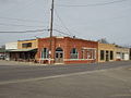
.jpg) Ponder State Bank | |
 Location of Ponder in Denton County, Texas | |
| Coordinates: 33°10′47″N 97°17′9″W / 33.17972°N 97.28583°W | |
| Country | United States |
| State | Texas |
| County | Denton |
| Area | |
| • Total | 3.39 sq mi (8.77 km2) |
| • Land | 3.38 sq mi (8.76 km2) |
| • Water | 0.00 sq mi (0.01 km2) |
| Elevation | 732 ft (223 m) |
| Population (2020) | |
| • Total | 2,442 |
| Time zone | UTC-6 (Central (CST)) |
| • Summer (DST) | UTC-5 (CDT) |
| ZIP code | 76259 |
| Area code | 940 |
| FIPS code | 48-58664[2] |
| GNIS feature ID | 1344345[3] |
Ponder is a town in Denton County, Texas, United States. The population was 2,442 in 2020.[4]
History
[edit]The community has the name of the local Ponder family.[5]
Local legend holds that Bonnie and Clyde either robbed the Ponder State Bank or attempted to rob it, only to discover it had gone broke the week before. However, this is not listed in the Barrow Gang's activities.[6] The robbery in question may have been committed by the less famous but more successful Eddie Bentz.[7]
Geography
[edit]Ponder is located at 33°10′47″N 97°17′9″W / 33.17972°N 97.28583°W (33.179741, –97.285805).[8]
According to the United States Census Bureau, the town has a total area of 3.2 square miles (8.3 km2), all land.
Demographics
[edit]| Census | Pop. | Note | %± |
|---|---|---|---|
| 1970 | 208 | — | |
| 1980 | 297 | 42.8% | |
| 1990 | 432 | 45.5% | |
| 2000 | 507 | 17.4% | |
| 2010 | 1,395 | 175.1% | |
| 2020 | 2,442 | 75.1% | |
| U.S. Decennial Census[9] | |||
| Race | Number | Percentage |
|---|---|---|
| White (NH) | 1,749 | 71.62% |
| Black or African American (NH) | 83 | 3.4% |
| Native American or Alaska Native (NH) | 15 | 0.61% |
| Asian (NH) | 29 | 1.19% |
| Pacific Islander (NH) | 1 | 0.04% |
| Some Other Race (NH) | 8 | 0.33% |
| Mixed/Multi-Racial (NH) | 134 | 5.49% |
| Hispanic or Latino | 423 | 17.32% |
| Total | 2,442 |
As of the 2020 United States census, there were 2,442 people, 798 households, and 600 families residing in the town.
Education
[edit]Ponder is served by the Ponder Independent School District,[13] which operates Ponder High School.
Notable person
[edit]- Joe McQueen (1919–2019), jazz musician, born in Ponder
Photo gallery
[edit]-
 Downtown Ponder, Texas
 -
 Former site of the Ponder United Methodist Church. The church moved to another building at 104 Remington Park Ln., next to the neighborhood of Remington Park.
 -
 Ponder Public Library and Town Hall.
 -
 Ponder State Bank, the site of the alleged robbing by Bonnie and Clyde.


Notes
[edit]References
[edit]- ^ "2019 U.S. Gazetteer Files". United States Census Bureau. Retrieved August 7, 2020.
- ^ "U.S. Census website". United States Census Bureau. Retrieved January 31, 2008.
- ^ "US Board on Geographic Names". United States Geological Survey. October 25, 2007. Retrieved January 31, 2008.
- ^ a b "Explore Census Data". data.census.gov. Retrieved May 22, 2022.
- ^ Moyer, Armond; Moyer, Winifred (1958). The origins of unusual place-names. Keystone Pub. Associates. p. 104.
- ^ Guinn, Jeff (2009). Go Down Together: The True, Untold Story of Bonnie and Clyde. New York: Simon & Schuster. ISBN 1-4165-5706-7.
- ^ Newton, Michael. Next to the famous Ranchmans Steak house they have recently built a subway on Bailey Street in 2012. The Encyclopedia of Robberies, Heists, and Capers. New York: Facts On File Inc., 2002. (pg. 32-33) ISBN 0-8160-4488-0
- ^ "US Gazetteer files: 2010, 2000, and 1990". United States Census Bureau. February 12, 2011. Retrieved April 23, 2011.
- ^ "Census of Population and Housing". Census.gov. Retrieved June 4, 2015.
- ^ Bureau, US Census. "City and Town Population Totals: 2020-2021". Census.gov. Retrieved February 26, 2023.
- ^ https://www.census.gov/ [not specific enough to verify]
- ^ "About the Hispanic Population and its Origin". www.census.gov. Retrieved May 18, 2022.
- ^ "2020 CENSUS - SCHOOL DISTRICT REFERENCE MAP: Denton County, TX" (PDF). U.S. Census Bureau. Retrieved October 3, 2022.
Municipalities and communities of Denton County, Texas, United States | ||
|---|---|---|
| Cities |  | |
| Towns | ||
| CDPs | ||
| Other unincorporated communities | ||
| Ghost towns |
| |
| Footnotes | ‡This populated place also has portions in an adjacent county or counties | |
| Authority control databases: Geographic |
|---|