12°23′56″S 74°52′0″W / 12.39889°S 74.86667°W
.mw-parser-output .hidden-begin{box-sizing:border-box;width:100%;padding:5px;border:none;font-size:95%}.mw-parser-output .hidden-title{font-weight:bold;line-height:1.6;text-align:left}.mw-parser-output .hidden-content{text-align:left}@media all and (max-width:500px){.mw-parser-output .hidden-begin{width:auto!important;clear:none!important;float:none!important))You can help expand this article with text translated from the corresponding article in Spanish. (February 2009) Click [show] for important translation instructions.
View a machine-translated version of the Spanish article.
Machine translation, like DeepL or Google Translate, is a useful starting point for translations, but translators must revise errors as necessary and confirm that the translation is accurate, rather than simply copy-pasting machine-translated text into the English Wikipedia.
Do not translate text that appears unreliable or low-quality. If possible, verify the text with references provided in the foreign-language article.
You must provide copyright attribution in the edit summary accompanying your translation by providing an interlanguage link to the source of your translation. A model attribution edit summary is Content in this edit is translated from the existing Spanish Wikipedia article at [[:es:Pampas]]; see its history for attribution.
You may also add the template ((Translated|es|Pampas)) to the talk page.
For more guidance, see Wikipedia:Translation.
Pampas | |
|---|---|
 Plaza de Armas, Pampas | |
 Flag  Coat of arms | |
| Nickname: Ciudad de los Cuchimichis (The Cuchimichis City) | |
 Pampas | |
| Coordinates: 12°23′55.76″S 74°52′12.78″W / 12.3988222°S 74.8702167°W | |
| Country | Peru |
| Region | Huancavelica |
| Province | Tayacaja |
| Established | 21 June 1825 |
| Government | |
| • Mayor | Jess Amrico Monge Abad |
| Area | |
| • Total | 52.264 km2 (20.179 sq mi) |
| Elevation | 3,276 m (10,748 ft) |
| Population | |
| • Total | 11,566 |
| • Density | 221.3/km2 (573/sq mi) |
| Time zone | UTC-5 (PET) |
| • Summer (DST) | UTC-5 (PET) |
| Area code | 067 |
| Website | www.munitayacaja.gob.pe |
Pampas is a city in Peru. It is the capital of the Tayacaja Province and it was established on June 21, 1825. According to the 2007 census had a population of 9,973 (11,566 in the metropolitan area).[1] It has an approximate altitude of 3,276 metres.
Transportation
[edit]The city is connected to the nearby cities like Huancayo and Ayacucho by partially paved roads.[citation needed]
Education
[edit]The city house a branch of the Universidad Nacional de Huancavelica and it is home of a local technical institute; the Instituto Tecnologico Pampas - Tayacaja.[citation needed]
Health
[edit]The city has now a new hospital, the Hospital Pampas that serve the city and the towns nearby.[citation needed]
Images
[edit]-
 A house in Pampas.
 -
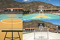 Futsal court in Pampas.
 -
 Slide in the "Parque Ecolgico de Pampas".
 -
 Gardens in the "Parque Ecolgico de Pampas".
 -
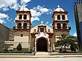 Cathedral of San Pedro de Pampas.
 -
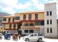 Municipality of Pampas.
 -
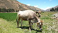 A cow in Pampas.
 -
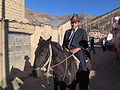 Pampino.


References
[edit]- ^ Instituto Nacional de Estadstica e Informtica (2007). "Censos Nacionales 2007: XI de Poblacin y VI de Vivienda" (in Spanish). Archived from the original on May 5, 2012. Retrieved November 12, 2008.
Statistics taken of the agglomeration from Acraquia (799), Ahuaycha (794), Daniel Hernndez (3.946) and Pampas (6.027)
External links
[edit]Wikimedia Commons has media related to Pampas (ciudad).
| International | |
|---|---|
| National | |