| This is a documentation subpage for Module:Location map/data/USA Arizona inset. It may contain usage information, categories and other content that is not part of the original module page. |
| name | Arizona | |||
|---|---|---|---|---|
| border coordinates | ||||
| 37.057531 | ||||
| -114.878894 | ←↕→ | -108.983781 | ||
| 31.278639 | ||||
| map center | 34°10′05″N 111°55′53″W / 34.168085°N 111.9313375°W | |||
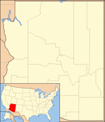
| image | Arizona Locator Map with Lower-Left Inset.png
| |||

| ||||
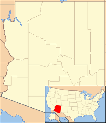
| image2 | Arizona Locator Map with national inset.png
| |||

| ||||
| image3 | USA Arizona location map.svg
| |||

| ||||
Module:Location map/data/USA Arizona inset is a location map definition used to overlay markers and labels on an equirectangular projection map of Arizona. The markers are placed by latitude and longitude coordinates on the default map or a similar map image.
Usage
These definitions are used by the following templates when invoked with parameter "USA Arizona inset":
((Location map|USA Arizona inset |...))((Location map many|USA Arizona inset |...))((Location map+|USA Arizona inset |...))((Location map~|USA Arizona inset |...))
Map definition
name = Arizona- Name used in the default map caption
image = Arizona Locator Map with Lower-Left Inset.png- The default map image, without "Image:" or "File:"
image2 = Arizona Locator Map with national inset.pngimage3 = USA Arizona location map.svg- Alternative map images which can be displayed via the AlternativeMap parameter
top = 37.057531- Latitude at top edge of map, in decimal degrees
bottom = 31.278639- Latitude at bottom edge of map, in decimal degrees
left = -114.878894- Longitude at left edge of map, in decimal degrees
right = -108.983781- Longitude at right edge of map, in decimal degrees
Alternative map
The ((Location map)), ((Location map many)), and ((Location map+)) templates have parameters to specify an alternative map image. The maps displayed as image2 / image3 can be used with the AlternativeMap parameter. Examples may be found below or in the following:
Precision
Longitude: from West to East this map definition covers 5.8951 degrees.
- At an image width of 200 pixels, that is 0.0295 degrees per pixel.
- At an image width of 1000 pixels, that is 0.0059 degrees per pixel.
Latitude: from North to South this map definition covers 5.7789 degrees.
- At an image height of 200 pixels, that is 0.0289 degrees per pixel.
- At an image height of 1000 pixels, that is 0.0058 degrees per pixel.
See also
Location map templates
- Template:Location map, to display one mark and label using latitude and longitude
- Template:Location map many, to display up to nine marks and labels
- Template:Location map+, to display an unlimited number of marks and labels