Unincorporated community in Illinois, United States
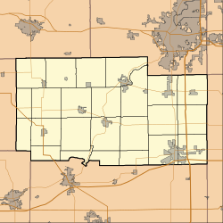
Lindenwood is an unincorporated community in Ogle County, Illinois, United States, and is located north of Rochelle, along the banks of the Killbuck Creek.
Geography
Lindenwood is located in Ogle County at latitude 42.053 and longitude -89.031, at an elevation of 771 feet, and is in the Central time zone (UTC-6).
Demographics
As of the census of 2000, there were 505 people among 192 households in the village. The racial makeup of the city was 97.0% White, 0.20% African American, 1.2% from other races, and 1.6% from two or more races. Hispanic or Latino of any race are 3.0% of the population.
There were 192 households, out of which 36.5% had children under the age of 18 living with them, 67.7% were married couples living together, 5.7% had a female householder with no husband present, and 34.5% were non-families. 19.8% of all households were made up of individuals, and 7.3% had someone living alone who was 65 years of age or older. The average household size was 2.63 and the average family size was 3.03.
In the city the population was spread out, with 25.9% under the age of 18, 6.4% from 18 to 24, 30.5% from 25 to 44, 20.2% from 45 to 64, and 17% who were 65 years of age or older. The population is divided 259 males and 246 females.
The median income for a household in the city was $47,625, and the median income for a family was $52,500. Males had a median income of $35,890 versus $25,058 for females. The per capita income for the city was $18,139. About 2.5% of families and 12.4% of the population were below the poverty line.


