Original file (670 × 750 pixels, file size: 741 KB, MIME type: image/gif , looped, 97 frames, 1 min 56 s)
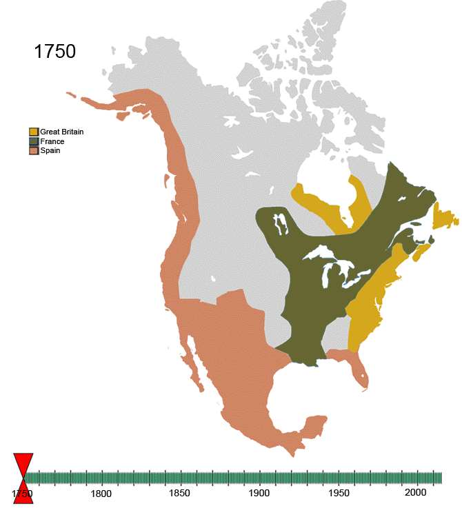
For notes on the individual border changes see Territorial evolution of North America . To make your own animated image use the slides below:
Images
See Also
|North America
|Central America
|Balkans
|South America
Summary
English Add a one-line explanation of what this file represents
Russian Колониальная Америка
Spanish Mapa de evolución de la colonización europea
German Karte Native Amerika Gebiete Evolution
File history
Click on a date/time to view the file as it appeared at that time.
Date/Time Thumbnail Dimensions User Comment current 14:32, 21 January 2010 670 × 750 (741 KB) Esemono See talk page 16:14, 19 January 2010 700 × 783 (537 KB) Maps & Lucy Correct version by same uploader which also exists as a different file. The Spanish explored but did not CLAIM the Pacific coast all the way up to the Russians. Do not revert! 13:28, 17 January 2010 670 × 750 (741 KB) Esemono Fix mexico 12:05, 12 January 2010 670 × 750 (731 KB) Esemono Reverted to version as of 23:46, 3 January 2010 01:23, 12 January 2010 670 × 750 (651 KB) Maps & Lucy Fixing map to make thumbnail version display 15:49, 11 January 2010 670 × 750 (651 KB) Maps & Lucy Reverted back to accurate image. The Spanish did not CONTROL the north Pacific strip, they just explored it and that does not count 23:46, 3 January 2010 670 × 750 (731 KB) Esemono Change Spanish control on the Pacific 07:45, 1 January 2010 670 × 750 (651 KB) Esemono Fix NWT island and UK Great Britian 01:32, 1 January 2010 670 × 750 (651 KB) Esemono Add pig war, and Rio Rico 13:15, 3 December 2009 670 × 750 (546 KB) Esemono timeline
Global file usage
The following other wikis use this file:
Usage on af.wikipedia.org
Usage on anp.wikipedia.org
Usage on ast.wikipedia.org
Usage on azb.wikipedia.org
Usage on az.wikipedia.org
Usage on be.wikipedia.org
Usage on bg.wikipedia.org
Usage on ca.wikipedia.org
Usage on ce.wikipedia.org
Usage on cs.wikipedia.org
Usage on da.wikipedia.org
Usage on de.wikipedia.org
Usage on el.wikipedia.org
Usage on en.wikiquote.org
Usage on es.wikipedia.org
Usage on fa.wikipedia.org
Usage on fiu-vro.wikipedia.org
Usage on fr.wikipedia.org
Usage on gan.wikipedia.org
Usage on gl.wikipedia.org
Usage on hi.wikipedia.org
Usage on hr.wikipedia.org
Usage on hu.wikipedia.org
Usage on hy.wikipedia.org
Usage on id.wikipedia.org
Usage on ja.wikipedia.org
Usage on ka.wikipedia.org
Usage on ko.wikipedia.org
Usage on la.wikipedia.org
Usage on lv.wikipedia.org
Usage on mk.wikipedia.org
Usage on mwl.wikipedia.org
Usage on new.wikipedia.org
Usage on nl.wikipedia.org
View more global usage of this file.


 |North America
 |Central America
 |Balkans
 |South America


