Dampierre-sur-Salon
CountryFrance
RegionBourgogne-Franche-Comté
DepartmentHaute-Saône
No. of communes50
SeatDampierre-sur-Salon
Government
 • Representatives (2021–2028) Dimitri Doussot
Martine Gautheron[1]
Area
632.54 km2 (244.23 sq mi)
Population
 (2021)[2]
10,747
 • Density17/km2 (40/sq mi)
INSEE code70 01

The canton of Dampierre-sur-Salon is an administrative division of the Haute-Saône department, northeastern France. Its borders were modified at the French canton reorganisation which came into effect in March 2015. Its seat is in Dampierre-sur-Salon.[3]

Composition

It consists of the following communes:[3]

  1. Achey
  2. Argillières
  3. Attricourt
  4. Autet
  5. Autrey-lès-Gray
  6. Auvet-et-la-Chapelotte
  7. Bouhans-et-Feurg
  8. Brotte-lès-Ray
  9. Broye-les-Loups-et-Verfontaine
  10. Champlitte
  11. Chargey-lès-Gray
  12. Courtesoult-et-Gatey
  13. Dampierre-sur-Salon
  14. Delain
  15. Denèvre
  16. Écuelle
  17. Fahy-lès-Autrey
  18. Fédry
  19. Ferrières-lès-Ray
  20. Fleurey-lès-Lavoncourt
  21. Fouvent-Saint-Andoche
  22. Framont
  23. Francourt
  24. Grandecourt
  25. Larret
  26. Lavoncourt
  27. Lœuilley
  28. Membrey
  29. Mont-Saint-Léger
  30. Montot
  31. Montureux-et-Prantigny
  32. Oyrières
  33. Percey-le-Grand
  34. Pierrecourt
  35. Poyans
  36. Ray-sur-Saône
  37. Recologne
  38. Renaucourt
  39. Rigny
  40. Roche-et-Raucourt
  41. Savoyeux
  42. Theuley
  43. Tincey-et-Pontrebeau
  44. Vaite
  45. Vanne
  46. Vars
  47. Vauconcourt-Nervezain
  48. Vereux
  49. Villers-Vaudey
  50. Volon

Councillors

Election Councillors Party Occupation
2015 Alain Blinette LR Mayor of Rigny
2015 Fabienne Richardot LR Mayor of Ferrières-lès-Ray

Pictures of the canton

View of Ray-sur-Saône
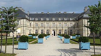
Champlitte Castle
Washhouse in Oyrières

References

  1. ^ "Répertoire national des élus: les conseillers départementaux" (in French). data.gouv.fr, Plateforme ouverte des données publiques françaises. 16 December 2022.
  2. ^ "Téléchargement du fichier d'ensemble des populations légales en 2021" (in French). The National Institute of Statistics and Economic Studies. 28 December 2023.
  3. ^ a b "Décret n° 2014-164 du 17 février 2014 portant délimitation des cantons dans le département de la Haute-Saône | Legifrance". Retrieved 2017-07-14.


47°34′N 5°41′E / 47.56°N 5.68°E / 47.56; 5.68