Caesar Creek State Park
Blue waters
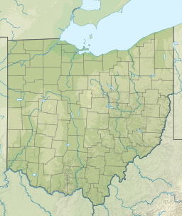
Caesar Creek State Park is located in Ohio
Caesar Creek State Park
Location in Ohio
Caesar Creek State Park is located in the United States
Caesar Creek State Park
Caesar Creek State Park (the United States)
LocationClinton, Greene & Warren counties, Ohio, United States
Coordinates39°29′30″N 84°02′21″W / 39.49167°N 84.03917°W / 39.49167; -84.03917[1]
AreaLand: 4,700 acres (1,900 ha)
Water: 2,830 acres (1,150 ha)[2]
Elevation843 ft (257 m)[1]
Established1978
Administered byOhio Department of Natural Resources
DesignationOhio state park
WebsiteCaesar Creek State Park
Caesar Creek Lake
Caesar Creek Lake is located in Ohio
Caesar Creek Lake
Caesar Creek Lake
LocationWarren / Clinton counties, Ohio, United States
Coordinates39°29′07″N 84°03′55″W / 39.48528°N 84.06528°W / 39.48528; -84.06528 (Caesar Creek Lake)[3]
Lake typeReservoir
Primary inflowsCaesar Creek
Primary outflowsCaesar Creek
Basin countriesUnited States
Max. length6.4 miles (10.3 km)
Max. width1.5 miles (2.4 km)
Surface area2,830 acres (1,150 ha)
Shore length136.3 miles (58.4 km)
Surface elevation797 ft (243 m)[3]
1 Shore length is not a well-defined measure.

Caesar Creek State Park is a public recreation area located in southwestern Ohio, five miles (8 km) east of Waynesville, in Warren, Clinton, and Greene counties.[2] The park is leased by the State from the U.S. Army Corps of Engineers, who in the 1970s erected a dam on Caesar Creek to impound a 2,830-acre (1,150 ha) lake.[2] The total park area, including the lake, is 7,530-acre (3,050 ha).

Fossil collection is allowed at Caesar Creek State Park with the following restrictions: No tools allowed, no fossil collecting for commercial use, all fossils kept must fit in the palm of your hand, and all fossil collection must take place in the designated fossil collection zone.[4]

Amenities

Dam

The dam is an earth and rock fill dam 165 feet (50 m) high and 2,750 feet (840 m) long. The Army Corps site is an area of 10,550 acres (4,270 ha). The watershed above the dam has an area of 237 square miles (61,000 ha). Construction started in 1971 and was finished in 1978.

The Army Corps site states:

"Congress authorized Caesar Creek Lake under the Flood Control Act of 1938. The Louisville District of the U.S. Army Corps of Engineers designed, built, and operates Caesar Creek Lake.
"During the fall and winter months, the lake level is lowered to prepare for the storage of heavy spring rainfall. If heavy rains occur, surface water runoff is stored in the lake until the swollen streams and rivers below the dam have receded. Once they can handle the discharge of the stored water without damage to lives or property, the extra water is released."[5]

The site is in the Warren County townships of Massie and Wayne.

Flooding of New Burlington

The construction of the Caesar Creek Lake flooded the small farming village of New Burlington, Ohio in 1978. The history of the community was collected through stories, letters, and journals in the book New Burlington: The Life and Death of an American Village by John Baskin.

References

  1. ^ a b "Caesar Creek State Park". Geographic Names Information System. United States Geological Survey, United States Department of the Interior.
  2. ^ a b c d "Caesar Creek State Park". Ohio Department of Natural Resources. Retrieved October 21, 2020.
  3. ^ a b "Caesar Creek Lake". Geographic Names Information System. United States Geological Survey, United States Department of the Interior.
  4. ^ "Louisville District > Missions > Civil Works > Recreation > Lakes > Caesar Creek Lake > Fossil Collecting". www.lrl.usace.army.mil. Retrieved March 20, 2021.
  5. ^ "Caesar Creek Lake". US Army Corps of Engineers. Retrieved October 21, 2020.

Sources