Bogotol
Боготол
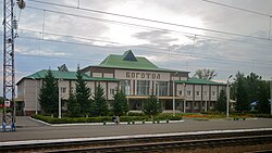
Bogotol railway station
Flag of Bogotol
Coat of arms of Bogotol
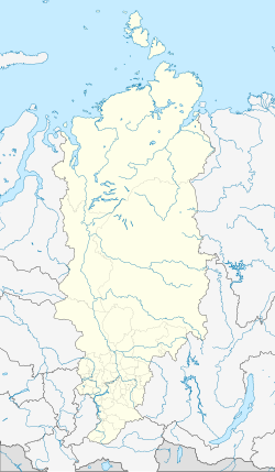
Location of Bogotol
Map
Bogotol is located in Russia
Bogotol
Bogotol
Location of Bogotol
Bogotol is located in Krasnoyarsk Krai
Bogotol
Bogotol
Bogotol (Krasnoyarsk Krai)
Coordinates: 56°12′N 89°31′E / 56.200°N 89.517°E / 56.200; 89.517
CountryRussia
Federal subjectKrasnoyarsk Krai[1]
Founded1893[2]
Town status since1911
Elevation
290 m (950 ft)
Population
 • Total21,051
 • Subordinated tokrai town of Bogotol[1]
 • Capital ofkrai town of Bogotol,[1] Bogotolsky District[1]
 • Urban okrugBogotol Urban Okrug[4]
 • Capital ofBogotol Urban Okrug,[4] Bogotolsky Municipal District[5]
Time zoneUTC+7 (MSK+4 Edit this on Wikidata[6])
Postal code(s)[7]
662060–662063
OKTMO ID04706000001
Websitebogotolcity.ru

Bogotol (Russian: Богото́л) is a town in Krasnoyarsk Krai, Russia, located 6 kilometers (3.7 mi) of the Chulym River and 252 kilometers (157 mi) west of Krasnoyarsk, the administrative center of the krai. Population: 21,051 (2010 Russian census);[3] 24,369 (2002 Census);[8] 27,752 (1989 Soviet census).[9]

History

It was founded in 1893[2] due to the construction of the Trans-Siberian Railway. The name derives from the Ket words bogotu (one of the Ket tribes in the area) and ul (river). Bogotol was granted town status in 1911.[citation needed]

Administrative and municipal status

Within the framework of administrative divisions, Bogotol serves as the administrative center of Bogotolsky District, even though it is not a part of it.[1] As an administrative division, it is incorporated separately as the krai town of Bogotol—an administrative unit with the status equal to that of the districts.[1] As a municipal division, the krai town of Bogotol is incorporated as Bogotol Urban Okrug.[4]

References

Notes

  1. ^ a b c d e f g Law #10-4765
  2. ^ a b Энциклопедия Города России. Moscow: Большая Российская Энциклопедия. 2003. p. 50. ISBN 5-7107-7399-9.
  3. ^ a b Russian Federal State Statistics Service (2011). Всероссийская перепись населения 2010 года. Том 1 [2010 All-Russian Population Census, vol. 1]. Всероссийская перепись населения 2010 года [2010 All-Russia Population Census] (in Russian). Federal State Statistics Service.
  4. ^ a b c Law #12-2510
  5. ^ Law #13-2868
  6. ^ "Об исчислении времени". Официальный интернет-портал правовой информации (in Russian). June 3, 2011. Retrieved January 19, 2019.
  7. ^ Почта России. Информационно-вычислительный центр ОАСУ РПО. (Russian Post). Поиск объектов почтовой связи (Postal Objects Search) (in Russian)
  8. ^ Federal State Statistics Service (May 21, 2004). Численность населения России, субъектов Российской Федерации в составе федеральных округов, районов, городских поселений, сельских населённых пунктов – районных центров и сельских населённых пунктов с населением 3 тысячи и более человек [Population of Russia, Its Federal Districts, Federal Subjects, Districts, Urban Localities, Rural Localities—Administrative Centers, and Rural Localities with Population of Over 3,000] (XLS). Всероссийская перепись населения 2002 года [All-Russia Population Census of 2002] (in Russian).
  9. ^ Всесоюзная перепись населения 1989 г. Численность наличного населения союзных и автономных республик, автономных областей и округов, краёв, областей, районов, городских поселений и сёл-райцентров [All Union Population Census of 1989: Present Population of Union and Autonomous Republics, Autonomous Oblasts and Okrugs, Krais, Oblasts, Districts, Urban Settlements, and Villages Serving as District Administrative Centers]. Всесоюзная перепись населения 1989 года [All-Union Population Census of 1989] (in Russian). Институт демографии Национального исследовательского университета: Высшая школа экономики [Institute of Demography at the National Research University: Higher School of Economics]. 1989 – via Demoscope Weekly.

Sources