.mw-parser-output .hidden-begin{box-sizing:border-box;width:100%;padding:5px;border:none;font-size:95%}.mw-parser-output .hidden-title{font-weight:bold;line-height:1.6;text-align:left}.mw-parser-output .hidden-content{text-align:left}You can help expand this article with text translated from
the corresponding article in Russian. (December 2023) Click [show] for important translation instructions.
View a machine-translated version of the Russian article.
Machine translation, like
DeepL or
Google Translate, is a useful starting point for translations, but translators must revise errors as necessary and confirm that the translation is accurate, rather than simply copy-pasting machine-translated text into the English Wikipedia.
Consider
adding a topic to this template: there are already 2,089 articles in the
main category, and specifying|topic= will aid in categorization.
Do not translate text that appears unreliable or low-quality. If possible, verify the text with references provided in the foreign-language article.
You must provide
copyright attribution in the
edit summary accompanying your translation by providing an
interlanguage link to the source of your translation. A model attribution edit summary is Content in this edit is translated from the existing Russian Wikipedia article at [[:ru:Балаклавский район]]; see its history for attribution.
You should also add the template ((Translated|ru|Балаклавский район)) to the
talk page.
For more guidance, see
Wikipedia:Translation.
Urban district in Sevastopol in Disputed:
Balaklavskyi District
Балаклавський район Балаклавский район |
|---|
|
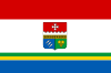 Flag 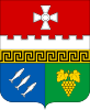 Coat of arms |
 Map of Sevastopol and its raions with Balaklava highlighted in red. |
| Country | Disputed: |
|---|
| Municipality | Sevastopol |
|---|
|
| • Total | 544.9 km2 (210.4 sq mi) |
|---|
|
| • Total | 27,620 |
|---|
| • Density | 82.17/km2 (212.8/sq mi) |
|---|
| Time zone | UTC+4 (MSK) |
|---|
44°30′0.15″N 33°36′0.12″E / 44.5000417°N 33.6000333°E / 44.5000417; 33.6000333
Balaklava District (Ukrainian: Балаклавський район, romanized: Balaklavskyi raion; Russian: Балаклавский район) is an administrative raion (district) of the city of Sevastopol.
The raion was created in 1930 as part of the Crimean ASSR with its administrative center in Balaklava. After World War II in 1957, it became part of Sevastopol city municipality. All populated places of the raion became incorporated with the city of Sevastopol. In 1976, the city of Inkerman was reinstated as a city. Population: 27,620 (2014 Census).[1]
The raion is subdivided into three municipality (councils): Inkerman city council, Orlyne rural council, and Ternivka rural council. Balaklava District borders with Bakhchysarai Raion and Yalta Municipality.
.svg)

