Royon | |
|---|---|
 Rebuilt château | |
 Coat of arms | |
Location of Royon  | |
 Royon  Royon | |
| Coordinates: 50°28′25″N 1°59′35″E / 50.4736°N 1.9931°E | |
| Country | France |
| Region | Hauts-de-France |
| Department | Pas-de-Calais |
| Arrondissement | Montreuil |
| Canton | Fruges |
| Intercommunality | CC Haut Pays du Montreuillois |
| Government | |
| • Mayor (2020–2026) | Jean-Marie Cornuel[1] |
| Area 1 | 7.49 km2 (2.89 sq mi) |
| Population (2021)[2] | 133 |
| • Density | 18/km2 (46/sq mi) |
| Time zone | UTC+01:00 (CET) |
| • Summer (DST) | UTC+02:00 (CEST) |
| INSEE/Postal code | 62725 /62990 |
| Elevation | 54–160 m (177–525 ft) (avg. 59 m or 194 ft) |
| 1 French Land Register data, which excludes lakes, ponds, glaciers > 1 km2 (0.386 sq mi or 247 acres) and river estuaries. | |
Royon (French pronunciation: [ʁwajɔ̃]) is a commune in the Pas-de-Calais department in the Hauts-de-France region of France.[3]
Geography
[edit]Royon is located 10 miles (16 km) east of Montreuil-sur-Mer on the D130 road, in the valley of the Créquoise river.
Population
[edit]| Year | Pop. | ±% p.a. |
|---|---|---|
| 1968 | 133 | — |
| 1975 | 135 | +0.21% |
| 1982 | 127 | −0.87% |
| 1990 | 117 | −1.02% |
| 1999 | 103 | −1.41% |
| 2007 | 117 | +1.61% |
| 2012 | 128 | +1.81% |
| 2017 | 135 | +1.07% |
| Source: INSEE[4] | ||
History
[edit]The slopes of hills in the region were blocked by thorny hedges of créquiers, the wild plum, and these hedges were called royons [5]
The first mention of Royon is in 893 in Gallia Christiana.[6] It is mentioned again in 1641 as 'Roion', and became 'Royon' in 1804.[7]
 |
 |
Places of interest
[edit]- The church of St. Germain, dating from the sixteenth century.[8]
- The Louis XV château, destroyed in May 1944.
- The present day château, home of the current mayor.
See also
[edit]References
[edit]- ^ "Répertoire national des élus: les maires" (in French). data.gouv.fr, Plateforme ouverte des données publiques françaises. 13 September 2022.
- ^ "Populations légales 2021" (in French). The National Institute of Statistics and Economic Studies. 28 December 2023.
- ^ INSEE commune file
- ^ Population en historique depuis 1968, INSEE
- ^ Balandra E. : Les rideaux ou royons picards aux XIIIe et XIVe, Bull. Soc. d' émulation d'Abbeville, 1980-XXIV, p. 757-763.
- ^ Gallia Christiana, XIV, p. 413, col A.
- ^ Dufetelle A. : Le Marquenterre, Monographie de Quend, Imp. Nouvelle, Abbeville, 1907.
- ^ Rodière R. : Dictionnaire épigraphique du Pas de Calais, Sède Ed., Arras, 1937
Wikimedia Commons has media related to Royon.
-
 Louis XV château, before World War II
 -
 Church of Saint-Germain
 -
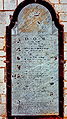 Tombstone of the de Bryas family
 -
 Transcription of words and symbols on the tombstone


| Authority control databases: National |
|---|