Ovett, Mississippi | |
|---|---|
 Ovett  Ovett | |
| Coordinates: 31°29′08″N 89°01′58″W / 31.48556°N 89.03278°W | |
| Country | United States |
| State | Mississippi |
| County | Jones |
| Area | |
| • Total | 1.74 sq mi (4.51 km2) |
| • Land | 1.73 sq mi (4.49 km2) |
| • Water | 0.01 sq mi (0.03 km2) |
| Elevation | 200 ft (60 m) |
| Population (2020) | |
| • Total | 183 |
| • Density | 105.66/sq mi (40.79/km2) |
| Time zone | UTC-6 (Central (CST)) |
| • Summer (DST) | UTC-5 (CDT) |
| ZIP code | 39464 |
| Area code | 601 |
| FIPS code | 28-54680 |
| GNIS feature ID | 694284 |
Ovett is a census-designated place and unincorporated community in southeastern Jones County, Mississippi. Ovett is part of the Laurel Micropolitan Statistical Area.
History
[edit]It was first established as a sawmill town in the early 20th century. Ovett is located on the former Gulf, Mobile and Ohio Railroad and was once home to six general stores, a blacksmith, pharmacy, three lumber companies, and two grocery stores.[2]
It was first named as a CDP in the 2020 Census which listed a population of 183.[3]
Camp Sister Spirit, a feminist retreat, is located in Ovett.[4]
Geography
[edit]Ovett is located just west of the De Soto National Forest and Highway 15. The community has a post office with the ZIP code 39464.[5]
Demographics
[edit]| Census | Pop. | Note | %± |
|---|---|---|---|
| 2020 | 183 | — | |
| U.S. Decennial Census[6] 2020[7] | |||
2020 census
[edit]| Race / Ethnicity (NH = Non-Hispanic) | Pop 2020[7] | % 2020 |
|---|---|---|
| White alone (NH) | 180 | 98.36% |
| Black or African American alone (NH) | 0 | 0.00% |
| Native American or Alaska Native alone (NH) | 0 | 0.00% |
| Asian alone (NH) | 0 | 0.00% |
| Pacific Islander alone (NH) | 0 | 0.00% |
| Some Other Race alone (NH) | 0 | 0.00% |
| Mixed Race or Multi-Racial (NH) | 2 | 1.09% |
| Hispanic or Latino (any race) | 1 | 0.55% |
| Total | 183 | 100.00% |
References
[edit]- ^ "2020 U.S. Gazetteer Files". United States Census Bureau. Retrieved July 24, 2022.
- ^ Howe, Tony. "Ovett, Mississippi". Mississippi Rails. Retrieved June 26, 2022.
- ^ "Ovett CDP, Mississippi". United States Census Bureau. Retrieved March 13, 2022.
- ^ Booth, William (December 12, 1993). "For Lesbian Couple, Mississippi Retreat is Hardly a Haven". The Washington Post. Retrieved June 26, 2022.
- ^ USPS – Cities by ZIP Code
- ^ "Decennial Census of Population and Housing by Decades". US Census Bureau.
- ^ a b "P2: Hispanic or Latino, and Not Hispanic or Latino by Race – 2020: DEC Redistricting Data (PL 94-171) – Ovett CDP, Mississippi". United States Census Bureau.
External links
[edit]Municipalities and communities of Jones County, Mississippi, United States | ||
|---|---|---|
| Cities | 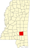 | |
| Towns | ||
| CDPs | ||
| Other communities | ||
| Indian reservation | ||
| Footnotes | ‡This populated place also has portions in an adjacent county or counties | |