- ^ "Geographic Names Information System (GNIS) Feature Class Definitions". U.S. Geological Survey. Retrieved 2011-07-26.
- ^ "Atlantic Cable Ski Trail". Geographic Names Information System. United States Geological Survey, United States Department of the Interior.
- ^ "Bad Finger Ski Trail". Geographic Names Information System. United States Geological Survey, United States Department of the Interior.
- ^ "Berkely Ski Trail". Geographic Names Information System. United States Geological Survey, United States Department of the Interior.
- ^ "Black Pine Ridge Trail Number 6". Geographic Names Information System. United States Geological Survey, United States Department of the Interior.
- ^ "Black Pine Trail". Geographic Names Information System. United States Geological Survey, United States Department of the Interior.
- ^ "Boulder Lakes Trail". Geographic Names Information System. United States Geological Survey, United States Department of the Interior.
- ^ "Butte Cabin Ridge Trail". Geographic Names Information System. United States Geological Survey, United States Department of the Interior.
- ^ "Butte Cabin Ridge Trail". Geographic Names Information System. United States Geological Survey, United States Department of the Interior.
- ^ "Catcha Wave Ski Trail". Geographic Names Information System. United States Geological Survey, United States Department of the Interior.
- ^ "Christmas Park Ski Trail". Geographic Names Information System. United States Geological Survey, United States Department of the Interior.
- ^ "Claimjumper Ski Trail". Geographic Names Information System. United States Geological Survey, United States Department of the Interior.
- ^ "Combination Trail Number 3". Geographic Names Information System. United States Geological Survey, United States Department of the Interior.
- ^ "Eightmile Harvey Ridge Trail". Geographic Names Information System. United States Geological Survey, United States Department of the Interior.
- ^ "Gold Bug Ski Trail". Geographic Names Information System. United States Geological Survey, United States Department of the Interior.
- ^ "Gold Rush Ski Trail". Geographic Names Information System. United States Geological Survey, United States Department of the Interior.
- ^ "Good Finger Ski Trail". Geographic Names Information System. United States Geological Survey, United States Department of the Interior.
- ^ "Grizzly Creek Trail". Geographic Names Information System. United States Geological Survey, United States Department of the Interior.
- ^ "Guns and Roses Ski Trail". Geographic Names Information System. United States Geological Survey, United States Department of the Interior.
- ^ "Haunted Forest Ski Trail". Geographic Names Information System. United States Geological Survey, United States Department of the Interior.
- ^ "Hi Line Trail". Geographic Names Information System. United States Geological Survey, United States Department of the Interior.
- ^ "Hogback Ridge Trail". Geographic Names Information System. United States Geological Survey, United States Department of the Interior.
- ^ "John Long Trail". Geographic Names Information System. United States Geological Survey, United States Department of the Interior.
- ^ "Limelight Ski Trail". Geographic Names Information System. United States Geological Survey, United States Department of the Interior.
- ^ "Little Finger Ski Trail". Geographic Names Information System. United States Geological Survey, United States Department of the Interior.
- ^ "Lower Willow Creek Trail Number Four". Geographic Names Information System. United States Geological Survey, United States Department of the Interior.
- ^ "Lums Run Ski Trail". Geographic Names Information System. United States Geological Survey, United States Department of the Interior.
- ^ "Maloney Trail Number 5". Geographic Names Information System. United States Geological Survey, United States Department of the Interior.
- ^ "Manhattan Ski Trail". Geographic Names Information System. United States Geological Survey, United States Department of the Interior.
- ^ "Maverick Ski Trail". Geographic Names Information System. United States Geological Survey, United States Department of the Interior.
- ^ "Medicine Ridge Ski Trail". Geographic Names Information System. United States Geological Survey, United States Department of the Interior.
- ^ "Mills Road Ski Trail". Geographic Names Information System. United States Geological Survey, United States Department of the Interior.
- ^ "Mother Lode Ski Trail". Geographic Names Information System. United States Geological Survey, United States Department of the Interior.
- ^ "Northern Lights Ski Trail". Geographic Names Information System. United States Geological Survey, United States Department of the Interior.
- ^ "Old Number Seven Ski Trail". Geographic Names Information System. United States Geological Survey, United States Department of the Interior.
- ^ "Otters Hump Trail". Geographic Names Information System. United States Geological Survey, United States Department of the Interior.
- ^ "Platinum Ski Trail". Geographic Names Information System. United States Geological Survey, United States Department of the Interior.
- ^ "Pole Ridge Trail". Geographic Names Information System. United States Geological Survey, United States Department of the Interior.
- ^ "Quigg Peak Trail". Geographic Names Information System. United States Geological Survey, United States Department of the Interior.
- ^ "Ranch Creek Trail". Geographic Names Information System. United States Geological Survey, United States Department of the Interior.
- ^ "Red Lion Ski Trail". Geographic Names Information System. United States Geological Survey, United States Department of the Interior.
- ^ "Sandstone Ridge Trail". Geographic Names Information System. United States Geological Survey, United States Department of the Interior.
- ^ "Sapphire Ski Trail". Geographic Names Information System. United States Geological Survey, United States Department of the Interior.
- ^ "Silver Bow Ski Trail". Geographic Names Information System. United States Geological Survey, United States Department of the Interior.
- ^ "Sluice Box Ski Trail". Geographic Names Information System. United States Geological Survey, United States Department of the Interior.
- ^ "Snaggle Tooth Ski Trail". Geographic Names Information System. United States Geological Survey, United States Department of the Interior.
- ^ "Solomon Ridge Trail". Geographic Names Information System. United States Geological Survey, United States Department of the Interior.
- ^ "Southern Cross Ski Trail". Geographic Names Information System. United States Geological Survey, United States Department of the Interior.
- ^ "Spooky Hollow Ski Trail". Geographic Names Information System. United States Geological Survey, United States Department of the Interior.
- ^ "Tenderfoot Ski Trail". Geographic Names Information System. United States Geological Survey, United States Department of the Interior.
- ^ "Terminator Ski Trail". Geographic Names Information System. United States Geological Survey, United States Department of the Interior.
- ^ "The Pitch Ski Trail". Geographic Names Information System. United States Geological Survey, United States Department of the Interior.
- ^ "Willow Harvey Divide Trail". Geographic Names Information System. United States Geological Survey, United States Department of the Interior.
Municipalities and communities of Granite County, Montana, United States | ||
|---|---|---|
| Towns | 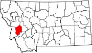 | |
| CDPs | ||
| Unincorporated communities |
| |
| Ghost towns | ||